

Deeper analysis of the High Arctic cold records (north of 80°N, July 2026):
This is a legitimate short-term regional anomaly captured by the Danish Meteorological Institute (DMI) using ECMWF operational model data. The dataset goes back to 1958 and focuses on the central Arctic Ocean area poleward of 80°N — a small, sea-ice-dominated region where summer temperatures typically hover near or just above freezing due to the melting ice acting as a thermostat.
What the Records Show
June 2026:
Averaged around -2.2°C — the coldest June in the 69-year record.
July 1–28, 2026:
Mean of approximately -0.01°C (essentially at the freezing point). Normally, July means in this region climb toward +1°C to +2°C or higher during peak summer.
Late July daily means set new marks:
- July 26: -0.35°C (coldest July daily mean on record).
- July 27: -0.26°C (second-coldest).
- July 28: -0.16°C (record for the date; fourth-coldest July reading overall).
These consecutive cold daily means in late July are exceptional for the time of year, when solar input is still strong (24-hour daylight). The graph you shared matches the DMI/ECMWF output.
Meteorological Context
Persistent weather patterns — likely involving cold air advection, specific circulation anomalies (e.g., troughing or northerly flow), and possibly favorable cloud/ice conditions — kept the central basin cooler. This contrasts with warmer conditions reported in parts of the broader Arctic (e.g., strong warmth in western Siberia in June).
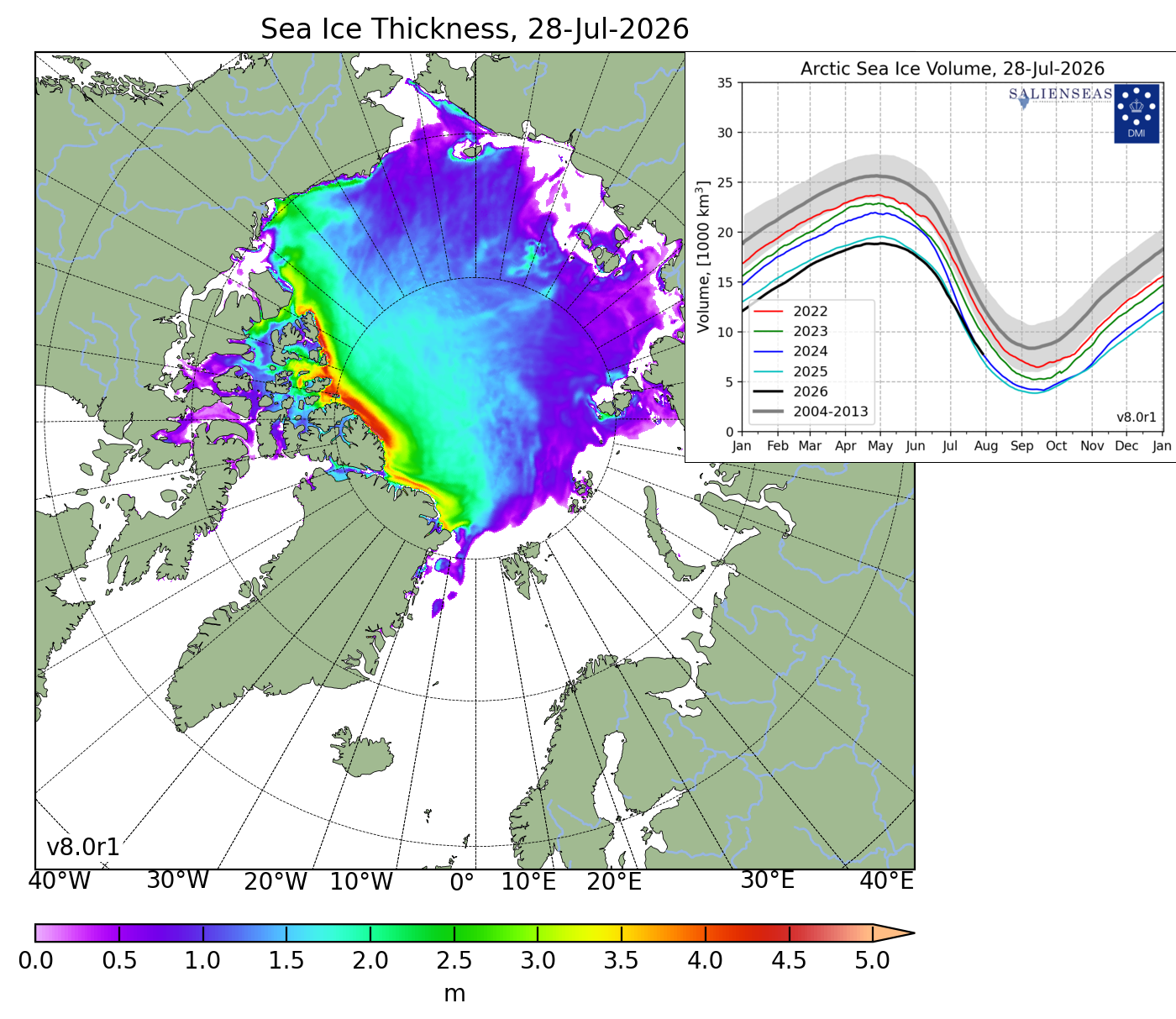
Sea ice extent in 2026 showed regional variation: very low in the Atlantic sector (Barents, Kara, etc.) but higher than recent norms in some Pacific-side areas. The cold temperatures in the high central Arctic likely helped preserve or slow melt in that specific zone.
Bigger Picture — Not a Reversal of Trends
Regional vs. Broader Arctic:
This is highly localized to >80°N. The wider Arctic (e.g., >70°N or land areas) saw overall warmer June conditions in many sectors, with record heat in places like northwest Siberia. Broader 2026 Arctic temperatures remained elevated relative to long-term averages despite this pocket.
Long-term Context:
The Arctic has shown strong warming and amplification over decades due to greenhouse gases, reduced ice albedo, etc. Summers have generally trended warmer, but natural variability (weather patterns, ocean circulation, etc.) still produces cold extremes. One cold summer month doesn’t overturn multi-decadal trends — winters have warmed more notably than summers in some analyses.
Sea Ice & Global:
Arctic sea ice remains in a long-term decline. In mid-July 2026, overall extent was below average (though not record-low for the date), with stark differences by sector.
This event highlights weather variability in the Arctic: even amid net warming, the High Arctic can still deliver surprising cold snaps in summer. It’s a useful reminder that single-region, short-term records need careful framing — they don’t negate broader climate signals, nor are they fabricated.
The DMI page for ongoing data is here: ocean.dmi.dk/arctic/meant80n.uk.php.

This is notable data for the High Arctic.
The chart (DMI/ECMWF operational model) shows daily mean temperatures north of 80°N for July 1–28, 2026. The region stayed very close to the freezing point most of the month (typical for high latitudes even in summer), with an overall period mean of -0.01°C.

Key Highlights from the Graph and Text
- July 26: -0.35°C → coldest July daily mean on record in the DMI dataset (back to 1958).
- July 27: -0.26°C → second-coldest July daily mean on record.
- July 28: -0.16°C → record low for that specific date and fourth-coldest July reading overall.
The sharp red drop at the end stands out against the earlier blue bars, which hovered around or slightly above 0°C for much of the month. Three consecutive record or near-record cold days in late July is unusual and extends a pattern of cold conditions in the High Arctic this summer.
Share this:

Discover more from Climate- Science.press
Subscribe to get the latest posts sent to your email.